Your download is ready. Click here to download.
About the Program
Many cities need additional or better data to help make policy decisions and solve problems but lack the capacity to collect the data. Citizen-Sourced Data initiatives are a cost-effective method for gathering a large amount of information about a city with the help of resident volunteers.
Often done in partnership with community organizations, Citizen-Sourced Data initiatives work best when they follow a simple procedure and when they seek to answer straightforward research questions about a challenge the city faces. There are many approaches to Citizen-Sourced Data initiatives, which vary according to the type of data collected and the available resources.
Citizen-Sourced Data initiatives have successfully been used to conduct a tree count, map urban heat islands, collect data about blight, and prepare for the census. A well-managed Citizen-Sourced Data initiative is not only an efficient way to collect data, but also empowers residents and strengthens their connection to local government.
Background: Citizen-Sourced Data in Flint
Citizen-Sourced Data initiatives have been implemented in a number of cities, including Flint, Michigan. After General Motors moved most of its manufacturing out of Flint, the city’s population fell 50% from its peak in 1960. This left many vacant and blighted properties throughout the city. Residents and city leaders wanted to make addressing blight in Flint a priority, but the city did not have enough data to create an effective plan or the resources to carry it out.
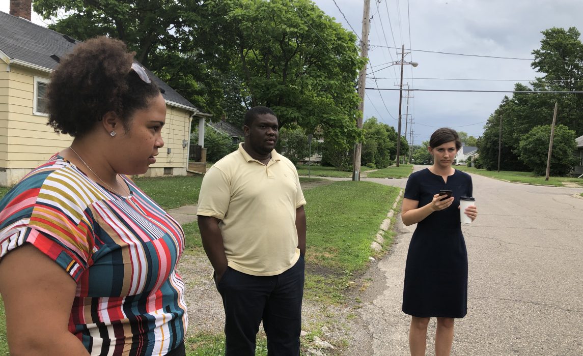
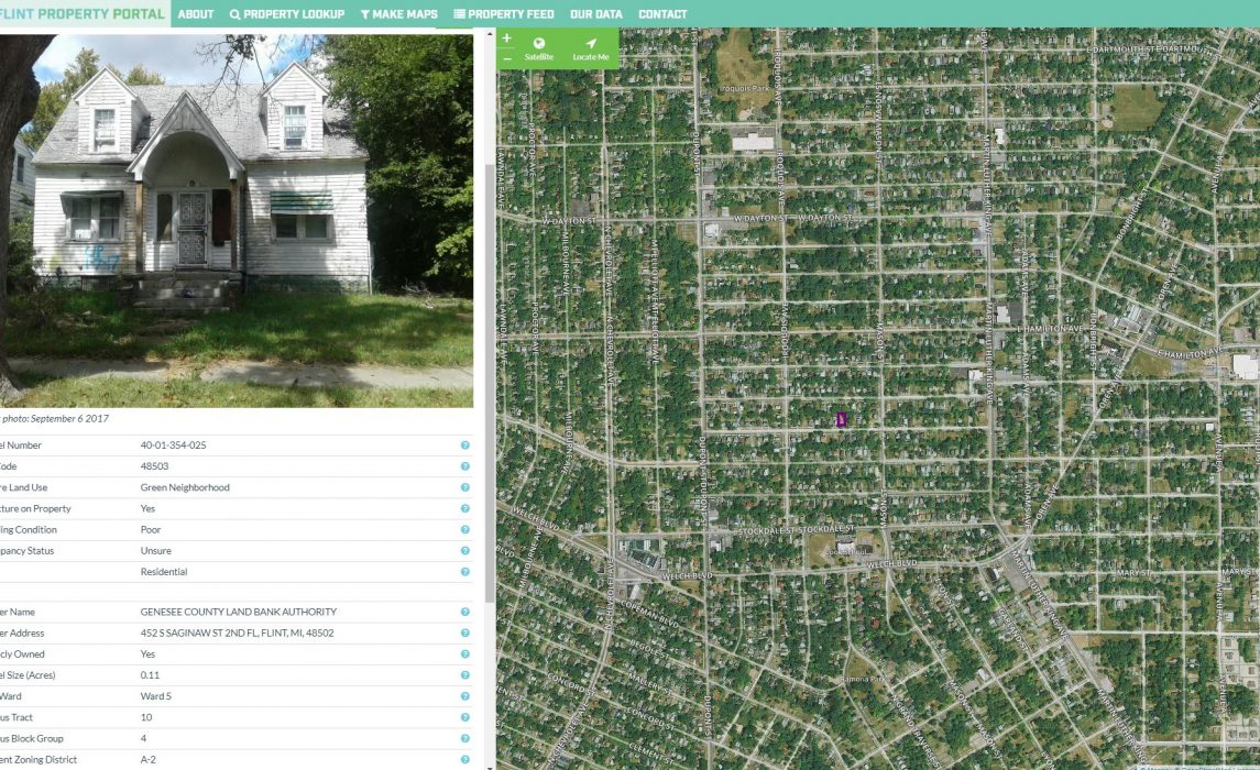
The city recruited community members to help address the lack of data. Community groups received a small stipend to collect information about properties during citywide Neighborhood Inventories, first on paper maps and then online via the Flint Property Portal. The city now has a comprehensive database of nearly every property in Flint, which city staff, nonprofits, funders, developers, police, and residents use and update regularly. With residents’ help, the city determined that that one in three properties was vacant and nearly 40% of them were blighted as of 2018.
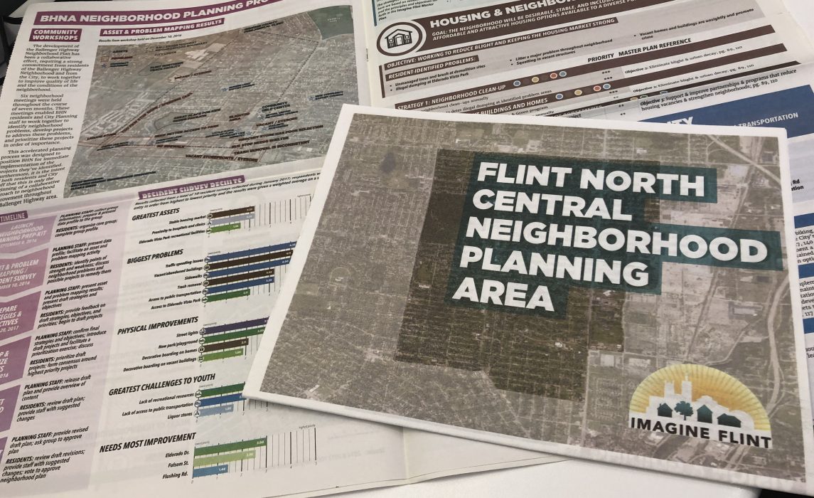
This data has helped the city apply for and receive a $60 million blight-elimination grant through the U.S. Treasury Hardest Hit Funds. While blight remains an ongoing challenge, the funds have been used to demolish over 4,000 blighted structures, more than 2,000 of which were the direct result of data entered by citizens through the portal. The data has also been used to increase the frequency and effectiveness of code enforcement visits, facilitated major development projects on three sites, and helped residents create and implement 13 neighborhood improvement plans.
How It Works
While there are many ways to implement a Citizen-Sourced Data initiative, there are a few essential steps that will make the initiative successful.
- Identify the data gaps that can be addressed with the help of community members. Work with partner organizations and residents to confirm that community members can help collect the data needed and that the problem the city is seeking to address is a priority for residents.
- Assemble a team of city staff to administer the initiative, and find partner organizations and community groups to assist with organizing and funding the data collection.
- Determine the best tool to collect the data. This might be paper maps, a smartphone app, or a messaging service.
- Working with partner organizations, recruit resident volunteers.
- Provide training for community members who will collect data. Inform volunteers of the purpose of the data and the role they play in the project.
- Work with partner organizations and community groups to organize and carry out data collection.
- Collect feedback from participants about the process and incorporate any needed changes into the initiative going forward.
- Share the data with residents and let them know how it will be used. It is also important to recognize volunteers for their efforts and provide additional opportunities for engagement with the data and with city government.
- Report the results of the initiative to residents and explain how the data has impacted a public problem or policy.
Step 1: Identify the Data Gaps
Every city needs more or better data to inform policy, improve service delivery, and solve public problems. The first step in a Citizen-Sourced Data initiative is to identify these data gaps. In New York City, for example, the city could not accurately budget for tree-planting projects until it knew the location and condition of existing street trees. The cost for the city to collect this data was prohibitive, so it enlisted volunteers.
Citizen-Sourced Data initiatives are most successful when they address a problem that is also a concern for residents. The problem could be concrete, like blighted buildings, or it could be more abstract, such as policies or services that could be improved with additional data. Once city leaders have identified where additional data is needed, they should work with residents and community groups to ensure that involving residents is practical and that communities are invested in the project. Residents will be more likely to participate when they feel strongly about the problem the city seeks to address.
Step 2: Assemble the City Team and Find Community Partners
City Team: A Citizen-Sourced Data initiative needs support from several city departments. In addition to members of the department that focuses on the chosen policy or public problem, assemble a team of officials with the following responsibilities:
- An official with long-standing relationships with the target community or communities
- An official who organizes citywide volunteer engagement, such as a chief service officer
- A communications official who can spread the message of the initiative widely to the community
- City council representatives or their staff who can share information about how the problem being addressed affects target communities
Community Partners: Partner with community groups such as nonprofits, faith-based organizations, and neighborhood associations that are trusted in the community, have a broad volunteer base, and have experience managing and training volunteers. These community groups can then work with the city to help design the data-gathering procedure, recruit and train volunteers, and manage the canvassing events.
The city may wish to incentivize participation in the process with small stipends to compensate community partners for their time. If funding for stipends is not available, the city should try to work with partners that have a vested interest in the community where they are gathering data. Access to new, accurate information about the community that could help the community group provide better services could be an incentive to participate, for example.
Funding Partners: If the city budget does not cover the cost of the initiative, outside funders may also be necessary to cover costs, such as developing new technology to collect and manage data.
Technology Partners: City leaders may also work with businesses or nonprofits that develop technology to provide or create a tool to collect the data (see Step 3 for more information).
Step 3: Choose the Right Tool
Paper forms or maps may work well for small-scale initiatives. For larger initiatives, consider smartphone technology, such as a mobile app or a text-messaging tool, which will be accessible to a large number of volunteers.
For some initiatives, a mobile app may already be available for volunteers to use on their smartphones. For others, the city may prefer to have a partner or contractor develop a tool. The tool should have simple functionality, multilingual capability, and the capacity to support many users at once. It should be compatible with common smartphone operating systems to ensure wide accessibility. And it should be easy for residents to use with minimal training.
Several organizations have experience developing these types of tools. The nonprofit Community Connect Labs develops simple messaging systems that gather data by asking users a series of automated questions by text message or through a mobile messaging app. They have worked with San Jose, California, and other cities to help them prepare for the census.
Flint worked with Loveland Technologies, which tailored its Landgrid platform for the city and created a web portal and app that asks a series of questions to collect data from users. There is a survey built into the portal designed specifically to collect information from residents during Neighborhood Inventories. It is important to note that some groups continue to use paper maps to collect data, which is then entered into the portal by staff, allowing groups uncomfortable with technology to participate.
Step 4: Recruit Volunteers
It is important to reach out to target communities to both recruit volunteers and explain the Citizen-Sourced Data initiative in advance of canvassing day so that community members are prepared for the presence of the volunteers.
The city team and community partners must recruit enough volunteers to complete the canvassing effort. Depending on the size of the initiative, it may be necessary to recruit a large number of volunteers for a single weekend or a smaller number of volunteers who are available over multiple days or on an ongoing basis. Consider volunteers with the following traits:
- Ability to canvass, which may include driving or walking long distances for several hours
- Familiarity with the target communities
- Familiarity with or interest in the public problem
- Proficiency in the language spoken in the community
- Proficiency in the technology that is being used to collect the data
Develop a clear and consistent message about the initiative, translate it into the appropriate languages, and share this information with schools, city council offices, shops, and branches of the public library. Partner organizations can help share this information, and the city should also share it widely through social and traditional media and at existing community group meetings and local events. Resident volunteers can assist in these efforts. Include volunteer sign-up instructions on all materials.
Step 5: Provide Training
Develop training materials for the volunteers who will be canvassing and, if necessary, the community partners who may also train participants. The training materials should provide instructions for using the smartphone or other technology and a detailed explanation of the data-gathering procedure. The materials should also include example photos to help volunteers identify the kind of information they should be recording. For example, the photos could illustrate the differences between blighted and non-blighted properties.
Check with community partners about the appropriate level of detail and language-accessibility needs for the volunteer training materials. Consider including maps of the canvassing areas in the training materials. Google Maps is an easy way to generate a visual representation of the canvassing area.
Flint, for example, developed a presentation with photos to teach participants how to rate properties on a scale of one through four, with one being in good condition and four being sub-standard (for example, the property had a cracked foundation or roof damage). The city teaches volunteers how to use the Property Portal and gives paper maps for those who are not comfortable using technology.
The training should also describe the goal of the larger project to participants. Explain the mission and purpose of their work, including what the data will be used for, and the part residents play.
Provide training on or shortly before the canvassing days to ensure the information is fresh in volunteers’ minds.
Step 6: Organize Data-Collection Events
Work with community partners to plan and manage canvassing days. Each volunteer group will canvass a designated area and use the technology or map to mark the data points they observe.
Set parameters for the canvassing days, such as the area that must be covered, the suggested number of volunteers, and the time that volunteers have to submit the data. Depending on the number of community partners and the number of volunteers, the canvassing effort may span multiple days.
City leaders may also wish to ask residents to contribute data throughout the year. In Flint, the city hosts ongoing workshops to train interested residents to use the portal, making it easy for them to update information about property conditions and report problems at any time, even if they haven’t participated in a Neighborhood Inventory before.
Step 7: Incorporate Feedback
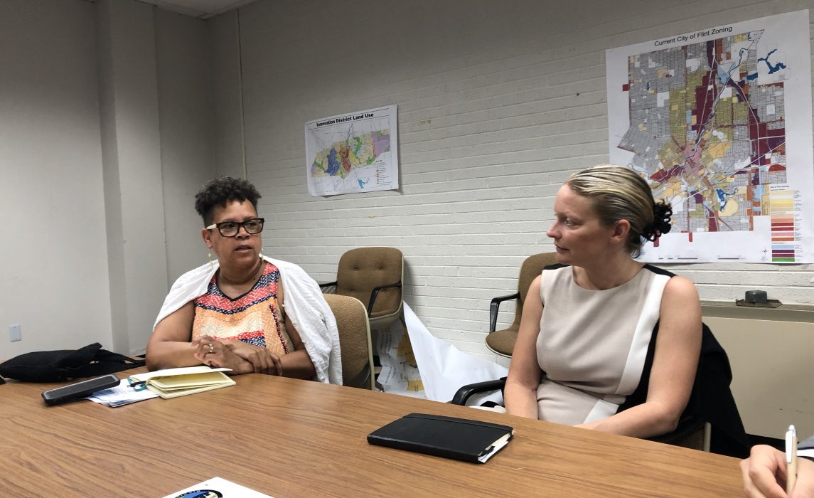
Assemble volunteers at the end of a canvassing period to learn about their experience in the field and gather feedback. The city staff and partners can then refine the process and technology as necessary. In Flint, the Neighborhood Inventories initially focused only on residential properties. Residents suggested gathering additional data, leading to inventories of commercial properties and city streetlights.
Step 9: Report Impact
It is especially important to measure the results of the project and how the data ultimately impacts a problem the city faces. These results should then be shared with residents and other stakeholders.
The city team should also share its experience developing and implementing a Citizen-Sourced Data initiative with stakeholders in the community and in other cities when possible. Stories of success will encourage other cities to use this engagement strategy to gather much-needed data to inform policy, improve service delivery, and solve public problems.
Citizen-Sourced Data in Action
Preparing for the Census with Citizen-Sourced Data in San Jose
Identify data gaps. In 2010, the census missed an estimated 6.8 percent of San Jose’s population, or nearly 68,000 people. This undercount may have caused the city to miss out on as much as $20 million in federal funding every year.
Most people are counted by the census when they receive and return a census form. In order to receive census forms, households must be in the Census Bureau’s Master Address File, but people living in low-visibility dwellings, such as converted garages or occupied RVs parked in a driveway, may be missing from the file. To establish a more accurate census count in 2020, the city needed to improve the Master Address File through the Census Bureau’s Local Update of Census Addresses (LUCA). City officials collaborated with residents to do it.
Assemble the team and find partners. The city team partnered with six community-based organizations to achieve broad reach across the city and depth at the neighborhood level. The community partners were required to attend two planning meetings, participate in the train-the-trainers event, and recruit, train, and organize volunteers for canvassing events. Each community partner was assigned a canvassing area that they were required to cover with at least 10 volunteers and submit their results within a week.To compensate the community partners for their time, the city offered stipends of $2,500 to each organization. With the funding came an expectation for high-quality data and constructive feedback.
Choose the right tool. The team worked closely with the nonprofit Community Connect Labs, which developed a text-messaging tool that allowed users to quickly record the location of low-visibility dwellings. The tool produced a single list that was shared only with city officials working on the census. When a volunteer saw a low-visibility dwelling, such as a garage converted into an apartment, they sent a text message to a designated phone number. The volunteer received back a series of questions (in English, Spanish, or Vietnamese) about the dwelling: Does it have its own entrance? Is it a garage, an apartment, a trailer, or something else? The user then texted the location of the dwelling using their smartphone’s location services.
Provide training. Community Connect Labs prepared training materials for the community partners and for the volunteers. The training materials for the community partners included background on the census, instructions for using the text-messaging tool, and detailed descriptions of different types of low-visibility housing.
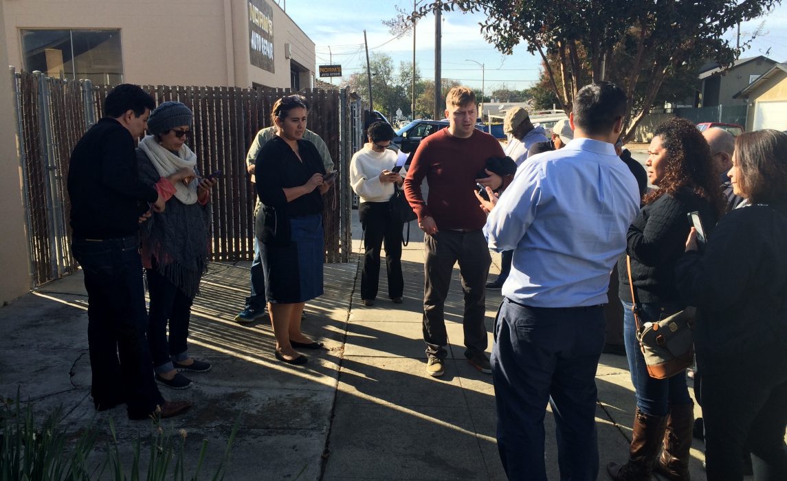
Organize data collection events. The city team consulted city council representatives and their staff to select 31 census block groups known to have high-density housing or high concentrations of unconventional or low-visibility housing. Volunteers were separated into pairs or small teams according to their language skills, knowledge of the neighborhood, technological proficiency, and comfort with different smartphone platforms.
Report impact. After volunteers covered all 31 census block groups, they had submitted over 800 potential low-visibility dwellings through the text-messaging tool. According to the U.S. Census Bureau, many of the submissions, particularly the converted garages and other unattached dwellings, were new to the Master Address File. Given that every additional person counted in the census could yield an additional $3,000 in federal resources per decade, the outcome from the pilot is potentially significant.

